
Key facts
- In July 2026, a Gabon patrol boat intercepted three unlicensed trawlers inside the Grand Sud Reserve after Global Fishing Watch analysts studied satellite data and identified where to look.
- Fifteen governments signed a declaration during the June 2026 Our Ocean Conference in Mombasa, pledging to disclose fishing-vessel ownership and whereabouts; seven signatories were African, including Somalia.
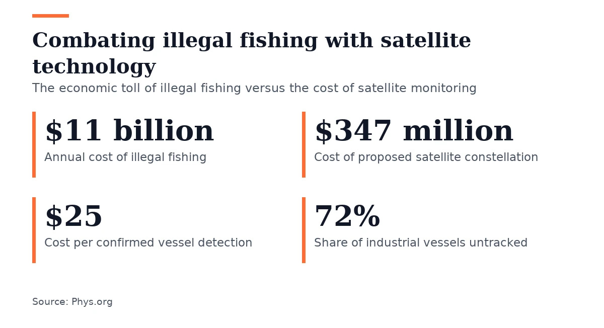
- The proposed constellation costs about $347 million over five years, or roughly $25 per confirmed detection, which the study describes as small compared with the $11 billion lost annually to illegal fishing.
- Dividing the $347 million constellation cost across the eight FISH-i Africa states equals about $69 million annually, or roughly $9 million per country each year for continuous coverage of shared waters.
Gabon authorities intercepted three unlicensed trawlers in the Grand Sud Reserve in July 2026 after Global Fishing Watch analysts studied satellite data and identified where to look, according to reporting by Phys.org.
The Grand Sud Reserve is one of West and Central Africa’s largest marine reserves, and Gabon bans industrial trawling there; the intercepted trawlers had no valid license. The reporting notes that most illegal fishing is never caught.
The reporting cites a 2024 finding from Global Fishing Watch researchers that most industrial fishing vessels worldwide do not show up in public tracking, with the estimated share between 72% and 76%. Much of that activity centers on South and Southeast Asia and Africa.
During the June 2026 Our Ocean Conference in Mombasa, 15 governments signed a declaration to disclose fishing-vessel ownership and whereabouts, with seven African signatories including Somalia. The reporting says African governments still rely on self-reporting and calls the declaration a transparency step that rests on a system most of the fleet has already left.
The reporting explains that public tracking depends on vessels sending their own positions through the automatic identification system, a collision-avoidance transponder that crews can turn off to avoid detection. Illegal fishing persists because public tracking relies on self-reported positions from a system most of the fleet has already left.
A Ph.D. candidate in aerospace engineering at the University of Florida, working with supervisor Norman Fitz-Coy, developed a satellite tracking system for the Somali Basin, a tuna ground between Somalia and Kenya in the western Indian Ocean that the reporting describes as rich but lightly patrolled. The study’s model put 24 satellites in a shell tilted 20 degrees to the equator, giving the basin revisits roughly every 1.1 hours against 3.4 hours for polar orbits, roughly three times more frequent coverage.
The reporting describes radar contact as a bright dot over a wide ocean area, while identifying a licensed trawler rather than a 7-meter skiff requires imagery with detail under a meter.

The reporting says a 100 kg radar satellite collects imagery for roughly 4.5 minutes per orbit before recharging for about 90 minutes, generating about 690 GB a day while regional ground stations can download only 120 GB to 360 GB. The satellite must sort images onboard before downlink because power and ground-station capacity constrain downlink.
The reporting identifies Malindi in Kenya and the Hartebeesthoek antennas operated by the South African National Space Agency as the primary regional ground stations. The study puts the proposed constellation at about $347 million over five years, or roughly $25 per confirmed detection, calling that small beside the $11 billion lost annually to illegal fishing.
Spreading the $347 million constellation cost across the eight FISH-i Africa states comes to about $69 million annually, or roughly $9 million per country each year for continuous coverage of shared waters. The reporting says FISH-i Africa unites eight western Indian Ocean states, including Somalia and Kenya, to share intelligence on suspect vessels. The reporting says African governments would not need to fund the constellation alone.
The reporting notes that FISH-i Africa, active since 2012, has managed over 35 investigations and secured fines and prosecutions over forged licenses and false identities, citing this as proof that states can enforce fisheries rules using information they already hold without waiting for new satellite capacity.
The study’s authors say the system breaks at enforcement rather than at the cameras, arguing that a vessel seen, identified and reported must still face interception, boarding, charges and a trial or detection yields cost without security. The authors stress enforcement depends on states sharing patrol costs and having the political will to act. In the Gabon case, the owner of the trawlers later settled with the authorities, and reaching that outcome required inspectors, prosecutors, courts and legal authority to board a foreign vessel.




Join the discussion