Key facts
- NASA scientists issued a warning that the 2026 El Niño is intensifying rapidly and could exceed the strength of the historic 1997-98 event, which caused severe weather extremes worldwide.
- Satellite observations from October 12, 2026, show striking similarities between the 2026 El Niño and the October 13, 1997, event, including elevated warm water extending to South America.
- NASA scientists at JPL processed satellite altimetry data from the TOPEX/Poseidon satellite for October 13, 1997, and from the Sentinel-6 Michael Freilich satellite for October 12, 2026, to compare the events.
- Successive satellite missions followed nearly identical paths with overlapping operation periods, giving researchers a 35-year record to compare El Niño events across decades.
NASA scientists warned through the agency’s Earth Observatory on Nov. 15, 2026, that the 2026 El Niño is strengthening fast and could grow stronger than the historic 1997-98 event, which caused severe weather extremes worldwide. The warning arrived while researchers compared the current El Niño with the historic 1997-98 episode.
On Oct. 8, 2026, NOAA estimated an 83 percent chance that El Niño conditions would rank as strong to very strong in the opening three months of 2027. The outlook points to a significant climate event without identifying where the worst effects will strike. NOAA said the figure measures the likelihood of strong to very strong conditions, not guaranteed impacts in any particular region.
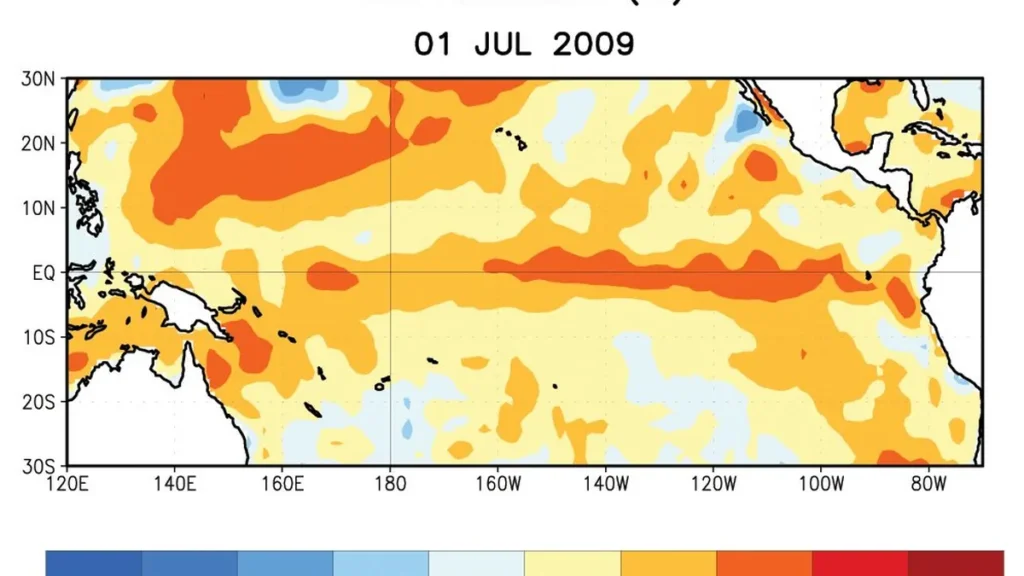
Researchers at NASA‘s Jet Propulsion Laboratory used altimetry readings (altimetry measures ocean surface height) from the TOPEX/Poseidon satellite for Oct. 13, 1997, plus readings gathered by the Sentinel-6 Michael Freilich satellite on Oct. 12, 2026, to compare the two events. The October measurements for both events showed low water in the western Pacific and high water in the east. Red shading marked higher-than-normal ocean levels across the central and eastern equatorial Pacific. Despite the matching patterns, the 2026 event came together much faster than the 1997-98 episode.
Scientists stripped out seasonal patterns and long-term trends from the satellite data so they could isolate sea level anomalies tied to El Niño. Scientists included Jason-2 satellite measurements from Oct. 12, 2015, alongside the 1997 and 2026 observations. Successive altimetry missions flew nearly identical paths with overlapping operations, giving researchers a 35-year record for comparing events across decades and judging the scale of the 2026 El Niño against 1997.
El Niño forms every two to seven years as ocean temperatures climb above normal across parts of the equatorial Pacific, disrupting atmospheric circulation far beyond the ocean. In normal conditions, steady trade winds push warm surface water toward the western Pacific, where heat builds up, leaving the ocean surface higher there than in the east. When the winds weaken, warm water surges eastward across the Pacific, which weakens or reverses the winds further and raises water temperatures and sea levels across the central and eastern Pacific.
Josh Willis, a project scientist with NASA’s Jet Propulsion Laboratory sea level missions, said the 2026 event’s resemblance to 1997 does not promise matching results because the atmosphere adds uncertainty. Every El Niño lands somewhere different and produces different impacts, so researchers see the visual match as their best current guess, not a certainty. Willis added that no two El Niño events take the same shape, since the outcome depends on where warm water builds up and how the atmosphere reacts.

During 1997-98, the El Niño drenched California and other parts of the southern United States with heavy rainfall, and it sparked destructive fires in Indonesia and the Amazon. Southern Africa saw severe drought and crop failures, and Southern California was hit by heavy rain and coastal flooding during that winter.
In 2015-16, warm equatorial water did not extend as far as South America the way it did in 1997 and 2026. Rain shifted to Central America and the southeastern United States, and Mexico saw significant flooding because unusually warm water remained farther west along the equator. Phys.org said the current 2026 El Niño rivals earlier very strong events such as 1997-98 and 2015-16, both of which upended weather patterns across the planet.
Scientists said how extreme the 2026-27 season gets will hinge on interactions between the ocean and the atmosphere in the coming months.
Forecasting becomes harder far away from the tropical Pacific since other atmospheric processes can change the patterns, and the NOAA outlook does not resolve where severe effects will hit geographically. Scientists said the long satellite record is a useful tool for recognizing familiar patterns and gauging how large the 2026 El Niño has grown. NASA Earth Observatory noted that researchers can use the 35-year record from nearly identical satellites to look back at 1997 and judge the scale of the current event.





Join the discussion