Key facts
- NASA's Opportunity rover previously held the record at 28.06 miles (45.16 kilometers) after exploring Mars from 2004 to 2018 over 5,111 sols.
- Perseverance landed in Jezero Crater on February 18, 2021, and reached the milestone on mission sol 2,006.
- NASA reports that more than 90 percent of Perseverance's driving used AutoNav, while Opportunity and Spirit relied on an earlier AutoNav for about 5 percent of travel.
- An engineering twin of Perseverance on Earth received a plaque from Guinness World Records celebrating the driving achievement.
NASA’s Perseverance rover reached 45.22 kilometers (28.10 miles) on Mars on October 11, 2026, setting the record for the farthest distance driven on another celestial body.sources
Perseverance surpassed Opportunity’s previous mark of 28.06 miles (45.16 kilometers), set during Opportunity’s 2004-to-2018 Mars mission of 5,111 sols. The new distance also exceeds the 22.2 miles (35.7 kilometers) driven by Apollo 17 astronauts on the Moon in 1972 and the 24.2 miles (39 kilometers) covered by the Soviet Union’s Lunokhod 2 rover in 1973.sources
Perseverance landed in Jezero Crater on February 18, 2021, and reached the milestone on mission sol 2,006.
Before reaching the mark, the rover paused for science work in an interesting area, and on Sol 1947 about two months earlier its odometer sat roughly 200 meters from the record distance. The team executed short drives for rock abrasions and proximity science on ancient rock outcrops before resuming longer drives. An engineering twin of Perseverance on Earth received a plaque from Guinness World Records celebrating the achievement.sources
NASA marked the record with an animated map showing the winding route since landing in February 2021. During the journey, Perseverance crossed an ancient lakebed, climbed through a fossilized river delta, and reached the rim of Jezero Crater.
NASA reports that more than 90 percent of Perseverance’s driving used AutoNav, while Opportunity and Spirit relied on an earlier AutoNav for about 5 percent of travel. AutoNav evaluates 600,000 terrain points each inspection to map terrain, spot rocks, steep slopes and sand traps, and choose a safe path. Since a command from Earth takes more than 20 minutes to reach Mars, AutoNav lets operators assign a destination while the rover selects the safest route.sources
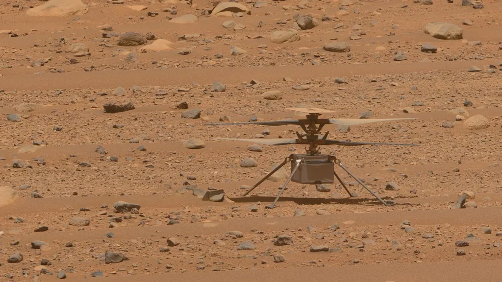
Onboard Global Localization repurposes the high-speed commercial processor inside the Ingenuity Helicopter Base Station to compare ground and orbital imagery and autonomously locate the rover in global coordinates after a drive. Unlike the main flight computer, the GBLC coprocessor is not radiation-hardened, and Martian surface radiation can induce transient bit flips in memory, so the team developed a software-based radiation hardening approach.sources
Engineers updated braking software to avoid rock hazards, nearly doubled steer motor current limits, added dynamic slip tables to flight software to model expected slip, and used cross-slope driving to anchor wheels on exposed bedrock. Following travel through boulder fields and steep slopes, the team raised the rover’s tilt limit to 24 degrees and reduced required belly-pan clearance to 20 centimeters (about 7.9 inches).sources
In December 2025, NASA ran two demonstration drives using vision-language models to study orbital imagery and terrain details, then built routes marked by waypoints. That vision-language AI flagged bedrock and logged outcrops, boulder fields and sand ripples before building a single route with waypoints to guide the rover. Perseverance traveled 689 feet on the first AI-planned drive and 807 feet on the second, with routes checked through a digital twin and more than 500,000 telemetry variables.sources
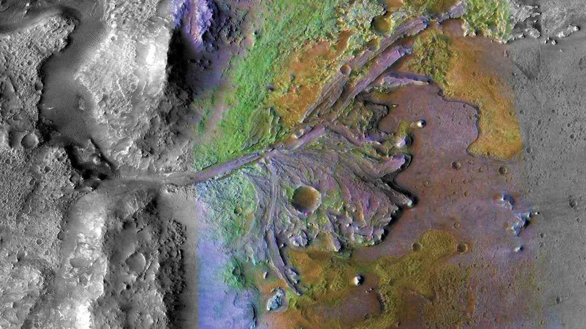
Human rover planners traditionally had to study orbital imagery and terrain data to select the waypoints that define a broader route, creating a bottleneck that generative AI is meant to remove. AutoNav and related autonomy tools keep taking out the stops, human planning and location checks that once restricted the distance a rover can travel. New software teaches Perseverance to steer less and roll more and to verify its position against orbital maps during a drive.sources
For NASA, setting mileage records is not the primary objective; the rover’s greater range lets scientists investigate more geological formations, examine more rocks and piece together Mars’ environmental history. Perseverance has gathered 29 samples of rock and regolith from environments including the crater floor, an ancient river fan, and the crater rim. While traveling through those early terrains, the rover studied a rock called Cheyava Falls, where scientists identified a potential biosignature, a feature or chemical pattern that could indicate past life.sources
After Lac de Charmes, which may be the oldest terrain ever examined in the solar system, Perseverance is expected to continue along the crater rim before heading south, with Rainbow Falls, a 328-foot-wide piece of ancient crust, as a future destination. The extended mission beginning in October lets the rover study Jezero Crater’s rim through approximately the end of 2028, and all mobility systems remain operational. Perseverance is driving toward Idubi where scientists hope to find evidence of ancient hydrothermal systems.sources
Sojourner, NASA’s first Mars rover, traveled approximately 330 feet (100 meters) during its 83-sol mission in 1997 and assessed roughly 20 terrain points. Spirit covered 4.8 miles (7.7 kilometers) before its mission ended in 2010 after failing to survive the Martian winter. Curiosity, which landed in Gale Crater in 2012 and remains active, has traveled more than 23.65 miles (38.07 kilometers).sources
Bright sunlight can interfere with navigation cameras, so planners halt driving by mid-afternoon when the rover heads toward the Sun. Finding ways to overcome navigation-camera glare from sunlight could allow Perseverance and future Mars rovers to spend more time exploring each day. Mars lacks tectonic plates, so similar rocks on its surface have not been erased by erosion and crustal movement the way rocks on Earth have, preserving ancient terrain for study.sources
NASA says Perseverance’s 28.10-mile record probably will not remain the record for very long, and the more significant achievement is how the rover reached the distance by steadily moving navigation decisions from operators on Earth to increasingly capable systems on Mars. The team is using hard-won lessons from 45 kilometers of driving to reinvent how the rover drives across the Martian surface.



Join the discussion