Key facts
- The model can learn delay variation patterns automatically from large data sets without relying on fixed rules.
- Spectral analysis of long-term GNSS data at the NanShan station found yearly and half-yearly cycles in zenith tropospheric delay variation, with bigger summer delays and smaller winter delays.
- The hybrid architecture uses a Gated Recurrent Unit to extract short-term dynamic features and a Long Short-Term Memory network to capture long-term trends.
- Small timing mistakes in VLBI can create major phase errors when combining data from radio telescopes around the world.
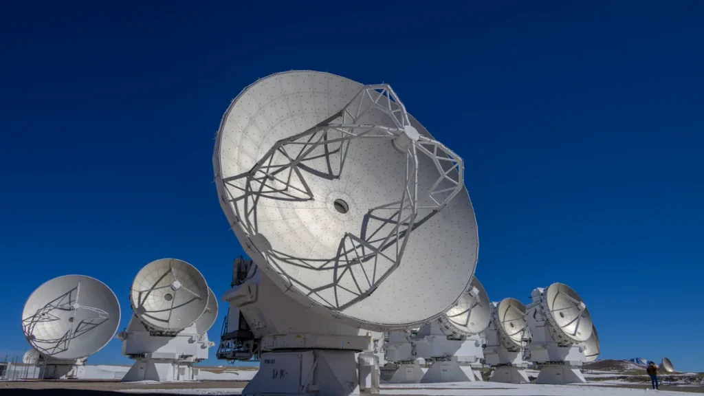
Researchers from the Xinjiang Astronomical Observatory of the Chinese Academy of Sciences created a hybrid deep learning model in October 2025 that forecasts Zenith Tropospheric Delay using data from the NanShan 26-meter Radio Telescope.
The team, led by LI Mingshuai, reported the work in Research in Astronomy and Astrophysics under DOI 10.1088/1674-4527/adf70f. The model produces an average error of about 8 millimeters and a 96% correlation coefficient. It combines Gated Recurrent Unit and Long Short-Term Memory networks to learn delay patterns automatically.
Tropospheric delay is a major source of error in Very Long Baseline Interferometry and Global Navigation Satellite System positioning. Radio waves slow as they pass through variations in air density and water vapor.
The model learns delay variation patterns automatically from large data sets without relying on fixed rules. That automatic learning ability separates the AI approach from rule-based empirical models built on predefined equations. The study identifies it as an important branch of artificial intelligence.
Spectral analysis of long-term GNSS data at the NanShan station found yearly and half-yearly cycles in zenith tropospheric delay variation. Bigger delays occur in summer and smaller delays in winter. These cycles track temperature and water vapor, so warmer and more humid conditions produce greater signal delay.
The Saastamoinen model and the Vienna Mapping Function are examples of these conventional tools. The Vienna Mapping Function converts slant delays into zenith delay values using elevation angles, drawing on pressure, temperature and humidity with statistical fittings to historical observations. That approach can create large errors in real-time or high-precision work.
The hybrid architecture pairs a Gated Recurrent Unit with a Long Short-Term Memory network. The Gated Recurrent Unit extracts short-term dynamic features, while the Long Short-Term Memory network captures long-term trends. Together they handle short-term ups and downs alongside seasonal patterns in signal delay.
Researchers trained the model using multi-year GNSS and meteorological data from the NanShan station. The combination of short-term dynamic feature extraction with long-term trend capture addresses limitations of older methods. Researchers chose deep learning because it can handle complex nonlinear behaviors automatically.
Small timing mistakes in VLBI can create major phase errors when combining data from radio telescopes around the world. If left uncorrected, the delay can cause GNSS positioning mistakes from a few centimeters to over one meter.
Tropospheric delay splits into a hydrostatic or dry component and a wet component. The dry part ties to stable atmospheric gases and is predictable. The wet part, caused by water vapor, changes a lot and is hard to model.
Conventional methods often fail to predict the wet delay accurately because of its erratic behavior. Better forecasting of the wet component matters for interferometry and positioning. The dry part is more stable, but the wet part drives much of the uncertainty.
High-precision tropospheric delay forecasts can improve atmospheric phase calibration for VLBI observations. They enhance radio source positioning and baseline solutions. The forecasts also support millimeter-wave astronomy with better meteorological data.
The results also apply to precipitable water vapor retrieval and weather forecasting. The observatory says the work helps high-frequency operations of the Qitai 110-meter Telescope. It also supports future multi-station interferometric observations.
Millimeter-wave astronomy needs precise real-time calibration because signal delay can sharply damage phase coherence and image quality. The forecasting models offer ongoing updates, which cut down on repeated recalibration and make telescope work more efficient.
Very Long Baseline Interferometry stands alone among space-geodetic methods. It delivers the complete set of Earth orientation parameters and access to the celestial reference frame. Analyzing its observational data currently requires a significant amount of human interaction.
The Group of Space Geodesy at ETH Zurich is investigating AI methods to increase automation of collecting and analyzing geodetic VLBI data. The group has already improved VLBI observation scheduling using Evolutionary Strategies. That approach collects observations more efficiently and improves derived geodetic parameters.
Matthias Schartner and Benedikt Soja, both at ETH Zurich, serve as contacts for the Group of Space Geodesy.
Fixing delay errors correctly matters for geodetic science because it lets researchers track tectonic motion and sea-level change. Better models improve GNSS-based measurement precision, and researchers use those measurements across Earth sciences and civil engineering.
The hybrid model outperforms conventional statistical and single-network approaches. Researchers adopted deep learning because traditional empirical models struggle to capture complex nonlinear behaviors in atmospheric delay. The model combines short-term dynamic feature extraction with long-term trend capture.
Join the discussion