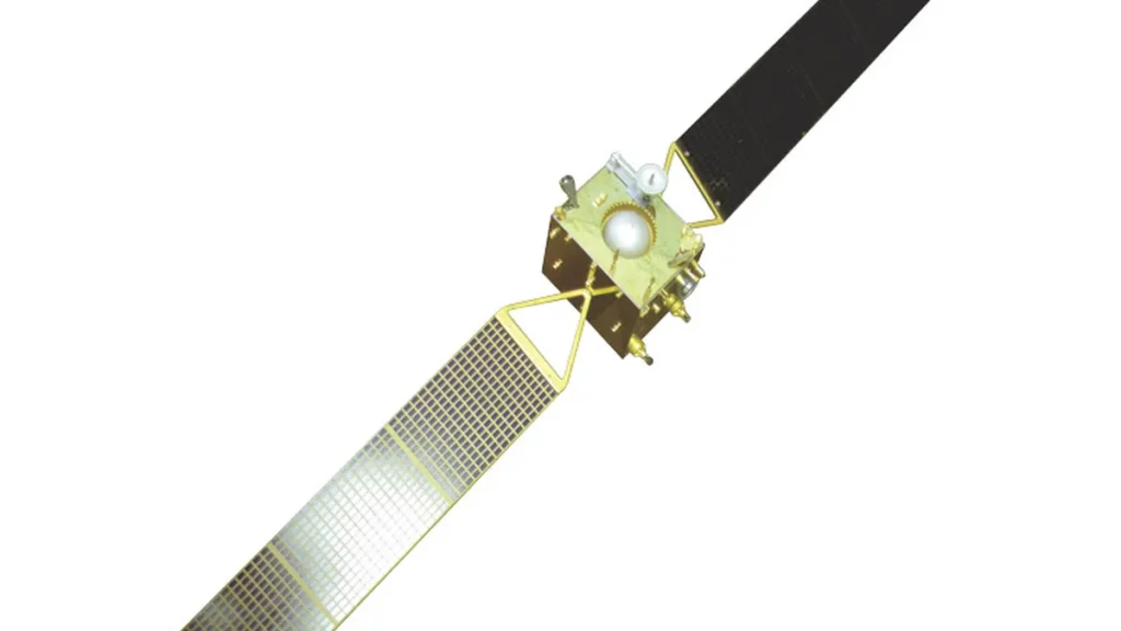
Orbital Sentry, a U.S. space startup, emerged from stealth after closing a pre-seed financing round led by Ridgeline in August 2026, with the funding supporting development of a persistent geostationary infrared system for continuous wildfire detection across the western United States. SatNews says the Fire Sentry package carries mid-wave and long-wave infrared sensors plus wide-area optics at 35,786 kilometers, holding steady over the same territory as Earth turns. Thanks to that unbroken stare, onboard software can reject short-lived false alarms and follow fire edges minute by minute while sending telemetry to spread models.
Conventional wildfire remote sensing relies on sun-synchronous satellites such as VIIRS and small satellite constellations like Muon Space FireSat, but their low Earth orbit passes create observation gaps of hours between thermal snapshots, SatNews reports. BriefGlance adds that commercial GEO weather satellites like GOES provide continuous data, yet their infrared sensors lack the spatial resolution needed to detect smaller, nascent events, and that VIIRS on NASA and NOAA satellites may pass over a fire’s location only once or twice a day. Germany-based OroraTech is building LEO constellations for wildfire detection, but these systems cannot offer the true 24/7 persistence that a geostationary platform provides.
BriefGlance says Fire Sentry is designed to detect wildfires within seconds when they are still small, often under an acre, and most manageable, while Orbital Sentry says Fire Sentry will identify ignitions within seconds of inception, track fire perimeters as they evolve, and predict expansion trajectories in near realtime across the Western United States. BriefGlance says the system catches blazes seconds after they break out while they are still small, often below an acre, and easiest to control. The same source adds that first responders could be dispatched with precise coordinates before a 911 call arrives, utilities could de-energize power lines threatened by an approaching fire, and insurers could gain situational awareness to manage risk and claims. InsuranceERM reports that the startup is actively building relationships with re/insurers who stand to gain earlier and more precise fire intelligence, and that the company views more persistent data as making wildfire detection faster and strengthening catastrophe model validation.
SatNews says the pre-seed money pays for building optical sensors, running calibration bench tests, and linking the gear to incident response software. Engineers are running focal plane array tests and payload engineering before an orbital demonstration flight, while the first spacecraft will hold a fixed cone over North America and later nodes widen the zone. The startup also works with the InnSure Creation Labs climate incubator to pipe steady thermal feeds into insurance catastrophe models. Pulse 2.0 adds that the financing will fund the expansion of early commercial and government partnerships.
The pre-seed round was led by Ridgeline, an early-stage venture capital firm founded in 2019 that invests in industrial networks, with offices in Memphis, Washington, D.C., and Los Angeles, StreetInsider reports. Superorganism, described as the first venture capital firm dedicated to biodiversity, and Hustle Fund, a 2017-founded pre-seed fund based in San Francisco, Singapore, and Washington, DC, also participated in the round. The amount raised was not disclosed, according to Pulse 2.0 and Fusion42. Fusion42 lists Orbital Sentry as a U.S.-based pre-seed Space Tech and Defense Tech startup, while SatNews describes the company as Washington-based and Noah Intelligence describes it as California-based.
For decades, the U.S. government has operated Overhead Persistent Infrared systems like the Space-Based Infrared System for missile early warning, and persistent GEO infrared monitoring has remained the exclusive domain of multi-billion-dollar military programs, BriefGlance reports. The startup aims to bridge the gap between government OPIR systems and commercial GEO weather satellites by developing a commercial system with the sensitivity to support real-time defense needs while addressing civilian crises. BriefGlance describes the backer mix as a dual-use play reaching government security buyers and the growing climate-tech sector. The U.S. Department of Defense and other agencies want commercial suppliers to add data to older systems.
Insured losses from U.S. wildfires regularly exceed tens of billions of dollars annually, BriefGlance cites. Orbital Sentry is commercializing fixed geostationary platforms to push unbroken data to electric utilities, catastrophe underwriters, and emergency response agencies, SatNews reports. “We’re building an entirely new space capability, the first commercial infrared geosynchronous imaging platform, which will enable a true livestream of the Earth,” says Dr. Mark Keremedjiev, CEO of Orbital Sentry. “One of the biggest challenges in wildfire science is understanding what happens between observations,” adds Andrew Notohamiprodjo, Chief Data Officer at Delos Insurance Solutions.
Orbital Sentry says its vision is steady intelligence flowing into decision systems as they happen, turning Earth observation from periodic reports into running data infrastructure that keeps up with planetary change.





Join the discussion