Key facts
- Current space-based laser instruments gather data one narrow line at a time, leaving enormous gaps of millions of acres that scientists never directly measure.
- NASA's CASALS instrument will combine machine learning with an ultra-compact lidar to adaptively sweep broad areas of Earth's surface and create three-dimensional topographical renderings.
- A team at NASA's Goddard Space Flight Center developed the Concurrent Artificially-intelligent Spectrometry Lidar System with support from NASA's Earth Science Technology Office.
- NASA physical research scientist John Yorks leads CASALS as Principal Investigator at Goddard Space Flight Center.
NASA’s Goddard Space Flight Center developed CASALS, the Concurrent Artificially-intelligent Spectrometry Lidar System, as a response to today’s space-based laser instruments measuring Earth one narrow line at a time.
The problem is one of coverage rather than a single missing measurement. Current space-based laser instruments gather data one narrow line at a time, leaving enormous gaps of millions of acres that scientists never directly measure. NASA explains that today’s orbital laser instruments produce isolated tracks rather than continuous coverage, so large areas between measurement lines go unobserved and blind spots remain.
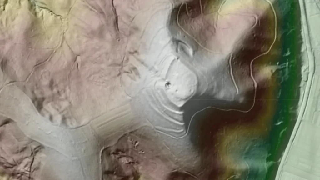
Goddard developed CASALS to close those blind spots and create truly three-dimensional topographical renderings. The instrument blends machine learning with an ultra-compact lidar, a laser-based ranging instrument, to map surface features adaptively across broad areas of Earth‘s surface. NASA calls this remote-sensing capability a way to produce full 3D topographical renderings and to close observational gaps left by earlier spaceborne lasers.
A team at NASA’s Goddard Space Flight Center developed the Concurrent Artificially-intelligent Spectrometry Lidar System with support from NASA’s Earth Science Technology Office to eliminate blind spots between lidar data lines. Multiple universities and NASA programs also sponsor the work alongside the center.
John Yorks, a physical research scientist at Goddard, leads CASALS as principal investigator. He described the transmitter and grating design that avoids motorized mirrors, a choice tied to better reliability for space operations because it removes heavy, failure-prone mechanical parts.
John Yorks leads the project at Goddard. NASA’s Decadal Survey Incubation and Instrument Incubation programs sponsor the work, alongside the University of California, Santa Barbara, and Virginia Polytechnic Institute and State University.
CASALS avoids motorized mirrors by steering light with wavelength itself to generate a continuous three-dimensional swath of the ground below. The system replaces mechanical beam steering with wavelength-based control. Yorks said removing heavy, failure-prone motorized mirrors improves reliability for space operations, and the approach produces a continuous ground swath rather than separate tracks.
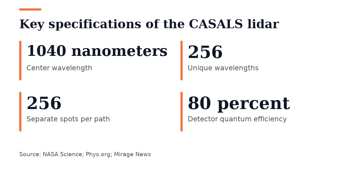
A fast-pulsing tunable seed laser centered at 1040 nanometers cycles through 256 unique wavelengths as it passes through a transmission grating, an optical component with microscopic ridges. Diffraction causes each wavelength to bend at a slightly different angle, so the grating directs each of the 256 pulses to a separate spot across the flight path. That physical effect spreads the pulses across distinct positions beneath the aircraft or spacecraft.
Removing moving parts drastically cuts the instrument’s size, weight, and power requirements. NASA says the non-mechanical design makes CASALS better suited to survive the harsh space environment and improves reliability. Eliminating motors and mirrors also removes the gaps between legacy lidar tracks.
CASALS’s detector array operates at 80 percent quantum efficiency, a measure of how well a sensor turns incoming photons into electrical signals. The sensor wastes almost none of the returning light, and it uses nearly all returning light. That efficiency is one of the instrument’s key innovations.
The high quantum efficiency lets CASALS detect weaker return signals, so the sensor can pick up faint reflections from the ground. That capability enables data collection from dark surfaces or thick vegetation, expanding the kinds of terrain the instrument can measure effectively.
The airborne CASALS prototype flew on NASA’s B200 King Air aircraft in November 2024, a flight that took place outside the laboratory. It produced science-quality data on its first campaign, exceeding expectations, and Yorks said the instrument worked well from its first flight and impressed the engineering team. The campaign produced usable science data right away.
At roughly five kilometers altitude, CASALS distinguishes individual tree branches and subtle ground elevation changes with 22-centimeter horizontal resolution. Yorks said this reveals fine vegetation structure and topographic detail.
The team plans to fly CASALS again in the Airborne Surface, Cryosphere, Ecosystem, and Nearshore Topography campaign. Known as ASCENT, the summer 2027 flight is the next planned airborne test of the prototype, and it is part of the path toward eventual spaceflight.
Before building a space-ready prototype, the team plans to widen CASALS’s swath and add onboard data processing software. The team needs these upgrades before transitioning from aircraft to orbit.
Should it succeed, CASALS may become the first spaceborne lidar able to map Earth’s forests and terrain as continuous three-dimensional swaths instead of isolated profiles, according to NASA. Success would give scientists a fuller picture of how forests and terrain are changing. Yorks said the team is working to mature airborne technology for a future spaceborne version.


Join the discussion